San Francisco to New York
April - June 2005
Week 3
9 May - Monday - 89.8 miles/720 total
Border UT to Delta UT
Sometime in the
middle of the night I realized that when I asked in the cafe what time
they opened for breakfast, and they said six, I should have asked if
that was mountain or pacific time. I decided it was probably pacific
time, so I decided to sleep an hour more, and then a little extra, on
the pretext that I didn’t really need a morning shower.
There was
supposed to be a new low moving in, replacing the low that had been
producing so much serious weather (although generally in places where I
wasn’t). There was to be a front with showers and thunderstorms,
starting around six in the evening in Salt Lake. I figured I’d better
get to Delta well before then to avoid getting wet.
The weather
people were also predicting heavy southwest winds, perfect for me as I
was heading generally northeast. But why do I believe weather people
when they predict tailwinds?
The wind was
heavy alright, but mostly southerly with an easterly component. For the
first forty miles, this meant strong crosswinds with significant
headwinds. So I was happy to start the climb to the first pass
(nameless), as the mountains largely blocked the wind.
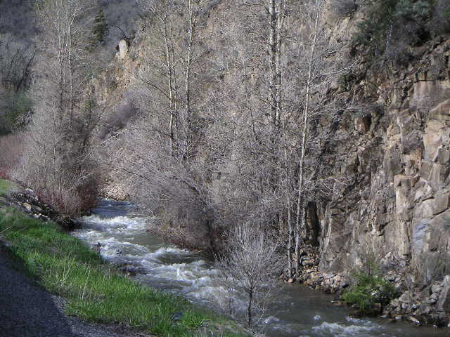
The descent from
that pass was through King Canyon, black vertical cliffs narrowing to
barely contain the road. There was a construction crew along this
section, apparently reinforcing the road with more dirt dumped along
the side. Real human beings! I may have left Nevada, but US 50 was
still pretty lonely here.
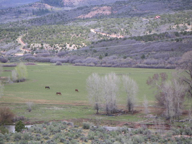
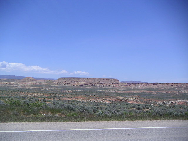
Then a flat
stretch, with the headwinds back, through some very pretty, meadow-like
rangeland, with giant buttes everywhere in the background. Following
this, a long climb through Skull Rock Pass (I looked for the skull but
didn’t see it), over a ridge, then at last, a view over a flat plain
filled with a huge shallow lake, Sevier Lake, marked on the map as
intermittent. There was definitely water in it today, and it was so
large I couldn’t see where it ended. But my road followed the edge of
the lake for miles, and kept going along the plain for more miles, and
now I had a real tail wind. It was mostly crosswind, but it must have
been going at 30 or 40 miles an hour - when I stopped for lunch I could
barely keep my bike upright and the sandwich in my hand. So I went
along for long stretches at 20 or 22 miles an hour, with little
pedaling effort. And even though my speed eventually dropped, I had a
real tailwind for 40 miles or so.
Hinckley was the
first town, 83 miles from the Nevada border. The farmed land around it
was amazingly green and neat after hundreds of miles of Nevada. Six
more miles to Delta, where I checked into a motel. It is now past eight
in the evening, and the threatened rain has not materialized.
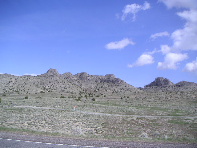 Buttes after King Canyon
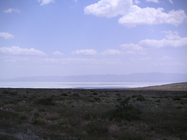 Sevier Lake
10 May - Tuesday - 0 miles/720 total
Delta UT
Overnight there
were intense thunderstorms, as predicted. I was awakened a couple of
times by very, very loud thunderclaps. When I got up, I was pretty
tired, it was wet outside, the forecast was not good, so it was time
for a rest day.
Delta is small
but apparently moderately prosperous, at least in comparison to most of
what I saw in Nevada. There’s a main street, US 50, and some
residential side streets, but not much else. In the center of town
there’s a very green park, very nicely kept up, with some shelters for
picnic tables, and off to one side, the town offices and library, all
very modern. In front of the library, Mark Twain sits, lifesize in
bronze, on a park bench, reading Huckleberry Finn. I wonder if the city
fathers who approved the statue had ever read Twain’s hilarious
critique of the Book of Mormon. The biggest thing in town, after the
high school, appears to be the LDS church.
There aren’t a
lot of places to eat here, and today I went to what appears to be the
most upscale place in town, the Pizza House (nicer than it sounds,
though), for a hamburger. For dinner I went back to the Mexican
restaurant adjacent to the motel, the same restaurant I ate in last
night. At least they have beer.
The rest of the day I dozed and watched TV. Well, I’m tired!
11 May - Wednesday - 0 miles/720 total
Delta UT
The forecast
today was as bad as yesterday’s. It was wet and raining slightly when I
got up, and the weather map showed the big low stalled over Salt Lake,
swinging spokes of thundershowers counterclockwise, with one of them
headed directly toward me. And it’s very cold. It seemed likely that
I’d get soaked and chilled if I rode on today, so it looks like another
enforced rest day.
Yesterday I
finally tried connecting my Palm Modem to the net by dialing directly
(at motel phone rates) rather than using a credit card. It works. So I
uploaded photos to the blog photo directory. I then discovered that I
couldn’t easily upload text to the blog, except in small pieces,
because the PDA’s clipboard holds only a small amount of text, making
it difficult to transfer text from a word processor file to the blog. I
need the clipboard to do this.
In the afternoon
I went to the town library, got on the internet, and managed to get the
pictures I’d uploaded, the ones from week one, to display in the blog.
So I went back to the hotel, uploaded the second week of photos, went
back to the library, and got those to display. This has turned out to
be a productive day, just because I’ve been so frustrated in not being
able to get the blog in shape.
The weather is
going to be better tomorrow and very nice for the next few days
afterward. I should have just four more riding days in Utah (to Vernal,
at least); maybe I can get them done without interruption from the
weather. After that, I may be able to make Fort Collins in four more
riding days. Then I’m done with the serious mountains.
12 May - Thursday - 82.1 miles/802 total
Delta UT to Payson UT
I was getting
antsy after two days of no riding, so I was glad to leave Delta.
Heading north on US 6 (goodbye to US 50 at last!) it was flat to
Lynndyl, with an occasional half-hearted shower. There I turned east
through dark flat farmland past Leamington, where it got a little
hilly. I passed some primitive nineteenth century charcoal ovens so
close to the road that there were Jersey barriers to protect them from
traffic. Soon after there was a cement plant, but that was the last
sign of civilization as I headed up into scrub uplands, over a nameless
pass and down into Nephi, which was farm country again.
My route north
now followed the valley and the interstate into Mona, where I came
close to looking for shelter in some new construction when hail and
rain started coming down fairly hard. But it soon let up, in time for
me to discover that the back road I was planning on taking parallel to
the interstate was closed. I got directions, too many directions
really, from the clerk at the country store cum gas station in Mona,
and went north on another parallel back road, around a reservoir and
down through a very nice canyon into Goshen.
Riding toward
Santaquin, the rain started again, and kept up for the rest of my ride
into Payson, where, slightly soggy, I checked into a chain motel. But
the weather is supposed to be better over the next three days.
Then a quick
trot across the motel parking lot in the rain to a ‘family restaurant,’
where I had a not very good dinner served by absurdly over-solicitous
waiters. And no beer, of course. Alas, to bicycle across Utah is to
know the pain and disappointment of Archy’s dessicated, beerless
pharaoh.
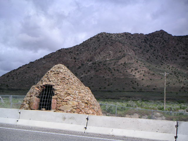 Old charcoal oven west of Leamington
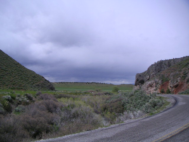 Canyon on a back road between Mona and Goshen
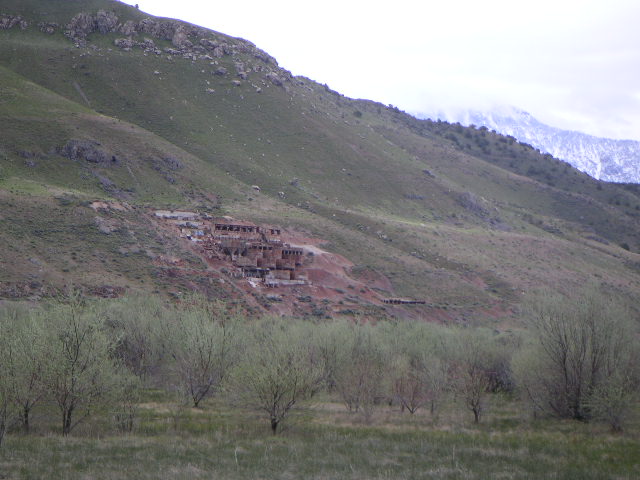 Strange mining works - South of Payson
13 May - Friday - 48.0 miles/850 total
Payson to Heber City
This was to be a
short day, so I got a late start, leaving at ten. Instead of following
US 6 toward Provo, I took some smaller roads that stayed closer to Utah
Lake. I figured that this route was likely to be flatter than the
highway that seemed uncomfortably close to the mountains. And it was
indeed very flat farmland. But off to the east I could see the huge and
apparently unbreached wall of the mountains - the Wasatch or the
Uintas, I haven’t figured out which.
Somewhere along
in here I passed the first road cyclist since the eastern Sierras. He
was going fast in the other direction and only waved.
At this point I
had to get onto US 89 in Santaquin, as that was the only road north
into Provo other than the interstate. As the interstate was clearly
flat and my road wasn’t, hugging the mountains as it did, this was a
little annoying. It was odd that a broad flat valley, well-populated,
didn’t have a secondary road running through it.
Once in Provo, I
got a little trapped in Brigham Young University and backtracked a bit
to get around it. On getting north of Provo, I headed east on US 189,
up through Provo Canyon, the gap in the mountain wall that allows the
road to get to Heber City. It was a climb of about 1000 feet, but a
gradual one.
Along this road
is photogenic Bridal Veil Falls as well as the road to Sundance. And
there were also campgrounds, where I would have camped except that I
wanted to make it to Heber City as the day’s mileage would be short
enough as it was.
At Heber City I
hit US 40, something of a nostalgic landmark for me. Not that I’d ever
been on this section of it, but when I was very young, before a lot of
the interstates were built, my parents would drive us from Pennsylvania
to Tulsa every couple of years, and we’d take long stretches of US 40
through the middle west.
I checked into a
Holiday Inn Express - not bad - and walked across the parking lot to a
pretty good steakhouse. It’s odd, though, that when I’m in a restaurant
in Utah where I can in fact get something to drink, I feel guilty
ordering it, as if I’m verging on a sacrilege of some sort.
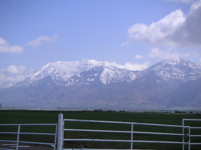 Wasatch or Uintas
 In Spanish Fork
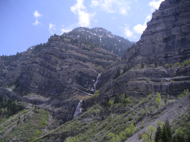 Bridal Veil Falls, near Sundance
14 May - Saturday - 69.3 miles/919 total
Heber City to Duchesne
I never got to
see downtown Heber City, as my motel was at a highway intersection a
little south of town. I allowed lots of time to climb Daniels Pass
(7980 feet), and assumed there would be no food all the way to
Duchesne, 70 miles away. So I took it easy on the climb, which was a
pretty steady uphill of 2400 feet or so along an overflowing stream -
or river, now, because of snow melt - and made the top of the pass
around eleven, earlier than planned in spite of the easy pace. At the
top there is a whole complex comprised of some sort of lodge hotel, a
gift shop, and a restaurant, a fairly tony one for the locale, where
they made me a turkey sandwich to take with me.
I headed
downhill, but the drop was quite gradual and rolling, and there was a
headwind, so I didn’t get a good payoff from the climb. Eventually I
passed a road cyclist going the other way, walking uphill (and
complaining of a headwind), who had been at a family reunion in
Altamount, 60 miles east, and had set out for Salt Lake early in the
morning. He had 16 miles to go to the top of the pass - I hope he
didn’t walk all the way! - but after that, if he followed the route I
had taken from Provo, it was all downhill or flat, and even though it
was another 100 miles, it was just noon. At any rate, his wife was
behind him in a car.
In Fruitland I
stopped at the little store and had a couple of ice cream sandwiches
and a short rest. Somewhere along in there I stopped at a very sixties
view area, arranged in front of some very picturesque cliffs and some
nicely contrasting pasturage. Too bad it wasn’t better kept up. A
little later, just before Duchesne, I stopped at another rest area,
more modern, very well kept up by a caretaker who happened to be there
and who wanted to talk. So he told me about the ‘gravity hills’ I must
have crossed in Nevada, where you’re pointing downhill but the local
warped gravity field pulls you backward. He seemed pretty serious about
this. There certainly were several climbs along US 50 in Nevada that
looked like they were descents because of the non-level horizon.
From there, it
was a short distance to Starvation Lake, which was supposed to have a
state park campground (with showers!) that I was thinking about staying
at, but I never saw the entrance. So I went a couple miles more into
Duchesne and easily found the one motel in town - cheap and reasonably
comfortable for the price - and checked in.
 Snowmelt, climbing to Daniels Pass, east of Heber City
 West of Duchesne
 West of Duchesne, viewed from a neglected, sixties-design rest stop
15 May - Sunday - 57.6 miles/977 total
Duchesne to Vernal
There were only 58 miles to do today, so there was no pressure to leave early, and I didn’t.
The dry
semi-desert on the west side of town changed suddenly to farmland on
the east. The fields here were soggy with irrigation. But the flat
horizontal lines of low red buttes were always in the background. The
road followed the Duchesne River downhill all the way to Roosevelt,
where I stopped for a pre-fab pizza lunch at a gas station convenience
store.
After Roosevelt,
it was dry again, flat, then a little rolling. Finally I climbed one
long and unexpected uphill to just before Vernal. In this stretch I saw
the first signs of an oil drilling rig, although I haven’t seen a
pumping jack yet. A good downhill, after which I checked into one of
the two local Best Westerns where I was supposed to be due a free night
(pay with MasterCard, stay three nights, fourth night free!). The motel
didn’t seem to know about this promotion - I have a feeling I’m not
going to get my free night.
At the motel
there were some guys with mountain bikes, come to ride the local back
country, one of whom had once ridden from Wyoming to New York on a
Serrota with a trailer. I asked him about the road ahead; he didn’t
think there would be a serious climb on my 90 miles tomorrow to Maybell.
 Low mesa, east of Duchesne