San Francisco to New York
April - June 2005
Week 4
16 May - Monday - 90.9 miles/1068 total
Vernal UT to Maybell CO
This morning I
had thirty miles to go to the Colorado border, which I’ve arbitrarily
decided is one third of the way across the country. I tried for an
early start, as today’s distance will be the longest since my 112 mile
day in Nevada. But I didn’t get away until a little before eight, as I
had a discussion with the motel clerk about my supposed free stay. I
probably will have to take this up with Best Western if I want my money
back.
At Jensen, the
main entrance to the Dinosaur National Monument is off to the north,
and at the intersection, of course, there’s a Sinclair gas station,
with its dinosaur logo. There’s an imposing chunk of mountain off to
the northeast, in the direction of all them bones.
I got to the
Colorado border before eleven, then rolled into Dinosaur, CO a little
afterwards. There I talked to the state welcome center about motels and
camping in towns ahead (unfortunately they didn’t know too much), then
went over to the Bedrock Café where they made me a pretty good sandwich
and fed me some homemade ice cream. The Bedrock Café is a recently
remodeled former soft ice cream place that had been famous for their
bronto burgers. Now it’s definitely upscale (for the locale), and the
work put into remodeling is very nice. There’s a kind of Memphis
effect, with high concept color-stained patterned wood flooring.
On then, past
entrance number two to Dinosaur National Monument. Somehow I have no
recollection of the town of Blue Mountain, but the mountain itself is
very imposing. From one side there’s a huge exposed anticline.
Apparently it’s a major soaring and hang gliding center, but I didn’t
see anyone in the air.
Past Elk
Springs, some serious rollers made their appearance. There must have
been something like ten of them, one after the other, each one climbing
a few hundred feet and dropping immediately after. But the grades
weren’t too bad, and most of them I went up without benefit of my small
chainring.
I got to Maybell
by five. There’s a town park there with camping and showers, but
there’s also an interesting old hotel with an interesting old
proprietor. Since the wind was picking up, and since it was supposed to
get cold and rainy overnight, I opted for the hotel, and got an earful
from the owner about his work as a project manager for trade shows.
Apparently he can live here in the middle of nowhere and, as long as he
has internet access, put together jobs for Las Vegas and New York trade
shows, driving or flying to the site when he needs to.
I had dinner at
the only restaurant, where the locals told me about the road to
Steamboat Springs (not too bad) and Rabbit Ears Pass beyond (really
bad). We’ll see.
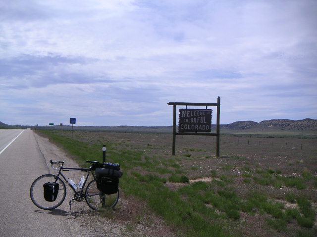 Colorado
17 May - Tuesday - 74.0 miles/1142 total
Maybell to Steamboat Springs
The Maybell
restaurant was closed for breakfast, as the owner had to take his dog
to the vet, so I made do with some orange juice and powdered sugar
coated doughnuts from the town store. But the weather was threatening.
The temperature had dropped almost 20 degrees overnight, it had rained,
and there was a dark line of heavy clouds on the western horizon.
According to the forecast, though, this would yield to cloudy but dry
skies early on. I waited for the dark clouds to pass by, and set off
around nine.
From the map,
I’d be following a river most of the way to Craig, and from Craig
onward, the road paralleled both a river - the Yampa - and a railroad
main line all the way to Steamboat Springs. So I expected a flat ride.
And that’s how it turned out.
Most of the way
it was pasture land or farm land. The rivers were overflowing their
banks, and there was a lot of riverside flatland that was either under
water or swampy.
At Craig, US 40
split into two parallel one-way streets, with my direction being the
one through the less nice part of town. By the time the two roadways
reconverged, I’d got past all of the possible places to stop for lunch,
and I didn’t feel like going back, so I stopped at the last convenience
store at the edge of town and asked about food ahead. Apparently
Hayden, 17 miles ahead, had a couple of good restaurants. When I got
there, Hayden turned out to be a nice town. I would have taken it for a
county seat, as I saw at least one lawyer’s office. I ate at a pleasant
deli - I was returning to civilization, apparently - and pedaled on
through Milner to Steamboat.
Outside of
Steamboat, there were some very large, nice looking houses - off by
themselves, not part of farms. And then at the western outskirts, there
was major development, with subdivisions.
I rode through
Steamboat looking for a B&B I had the address of and also for the
Comfort Inn, finding neither one. But I stopped toward the eastern edge
of town at the Rabbit Ears Motel, which looked fairly nice, was cheap,
and it turns out, was built in the year of my birth. Since I was going
to climb Rabbit Ears Pass next, the name seemed like a good omen, and I
checked in.
My first duty
was to do laundry - there was a laundromat in the motel. Then I went to
the town library, open from nine to eight, amazingly enough, and did
some work on the blog.
There’s lots of
good food in Steamboat. There are several restaurants with exotic and
expensive game items on the menu - elk steaks, for instance - and
apparently serious places with actual, real, fresh fish on the menu.
But I went to a place that had a Tuesday night prime rib special, ate too much, walked home, and went to bed.
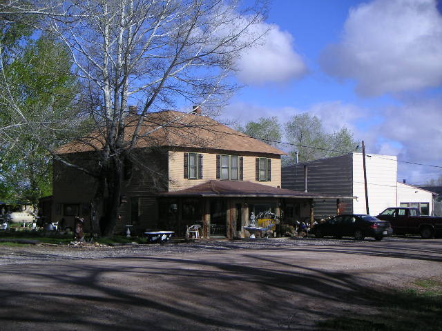 Last night's lodging in Maybell
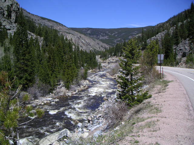
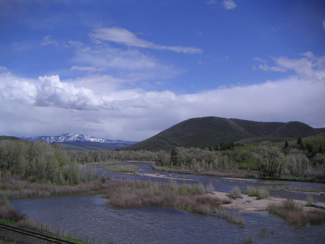 Overflowing Yampa, east of Craig
18 May - Wednesday - 0 miles/1142 total
Steamboat Springs
Today was a rest
day. I had figured I needed a day off before Rabbit Ears Pass, and I
had just done six days without a break, so this was a logical day to
take off. In the morning, though, I bumped into a cyclist from Boulder
who was staying at the motel and who was the organizer of a group of 30
cyclists that had come to town to do some riding here. He said he’d
done most of the serious passes in Colorado, and told me not to worry
too hard about Rabbit Ears. But it’s just as well to take a day off.
I’m likely to take about one off per week from here on in anyhow.
I uploaded some
photos to the blog from my PDA this morning, then went over to the
library to update the blog text to include them in the blog. Then I
walked into a clothing shop and asked for a recommendation for a tailor
- one of my two pairs of pants needs its zipper repaired. So I dropped
off the pants, had some lunch (a grilled salmon steak on focaccia -
very good), then picked up the pants (unfortunately she didn’t have the
right slider replacement, so the repair isn’t ideal). Then I found a
coffee shop, recommended by the tailor, and had a latte and bit of
pastry while continuing to update this journal, something I’d started
over lunch. I had six days to do, working from handwritten notes.
For dinner, I
found a fairly high-toned restaurant, where being alone I was seated at
the kitchen bar (as opposed to the bar bar), in front of the chef, who
fed me salad, seafood fra diavolo, and a tarte tatin. All very good,
with the tarte being slightly higher concept than you expect that sort
of thing to be (ice cream, caramel sauce, cigarette cookie, mint leaf).
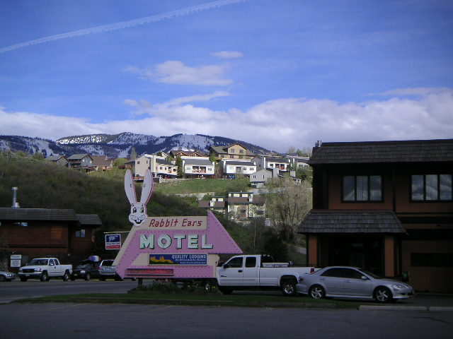 Home in Steamboat Springs
19 May - Thursday - 59.5 miles/1202 total
Steamboat Springs to Walden
It was about 24
miles from town to Rabbit Ears Pass, according to the map. The pass is
9300 feet, 2700 feet above Steamboat. On the way out of town I picked
up a pre-packaged sandwich, as it looked as if there was no
civilization all the way to Walden, where I planned to stay the night.
The climb
started at about four miles, and it was fairly steep, and stayed that
way. I was resting a couple of minutes every couple of miles, and about
eight miles up I figured I had another twelve miles to go.
But just then I
heard a voice behind me - it was a woman on a road bike, saying,
“you’re almost there - it’s just around that bend.” Not quite, but the
west summit was only two miles ahead. By the time I got there the
woman, and a man who had been just behind her, were on their way back
to town. From there, it was either flat or a bit rolling (with one big
dip) for a few miles until the east summit and the continental divide,
where I found the cyclist I had spoken to yesterday at the motel, along
with several of his friends. They had ridden up from Kremmling. He
snapped my picture in front of the continental divide sign, and then I
went on down to Muddy Pass, which goes downhill past another
continental divide sign. Here I turned onto Colorado 14 and headed to
Walden.
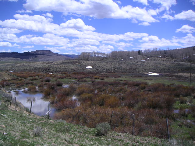
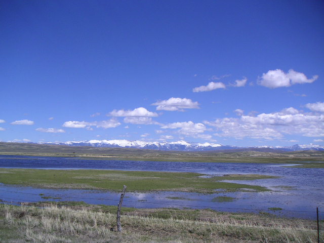
The road tended
downhill though scrub ranchland at first, a little desolate but quite
beautiful, with great copper colored expanses of low bushes running
along the flooded creeks. Then it flattened out and became very nice
grazing land with little irrigation ditches running everywhere,
competing with the overflowing streams. There were cows (not steers)
everywhere and even buffalo. The colors at this elevation (8000 feet)
were astonishing - the deep blue of the sky and the various colors of
green all reflected in the water, with pale yellow straw and reeds
pushing up through the water of ponds and swamps.
There was one
last long climb before Walden, where I found a motel, regretfully
eschewing the Antler Inn (obviously very nice, here in the middle of
nowhere, but a lot more expensive than the motel). But I had dinner in
the Inn’s restaurant, two huge pork chops and some cherry pie.
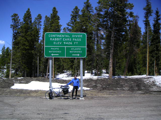 Continental Divide at Rabbit Ears Pass
 On CO 14 southwest of Walden
 Another view from CO 14
20 May - Friday -102.3 miles/1304 total
Walden to Fort Collins
Today was to be
a high mileage day, the first, really, since Nevada, but mostly
downhill. But in the first thirty miles, I’d be crossing Cameron Pass,
the highest point on the trip at 10276 feet.
The road out
from Walden was pretty flat. I passed a viewing point for the Arapaho
National Wildlife Preserve, which was sited at a point that revealed a
huge flat meadow ringed by mountains, called the “bull pen” by the
Indians because the mountains effectively kept their game on the meadow.
The climb for
most of the way to the pass felt nearly flat. I knew I must be gaining
altitude, but it didn’t feel like it. But the vegetation was changing,
turning from grassland to farmed conifer forest, then to lodgepole
pine. About five miles from the top, I did begin feeling the effort of
the climb. It got a bit steeper (though never really steep) and near
the top I really felt the lack of oxygen. There was a fair amount of
snow, as there had been at Rabbit Ears, but it didn’t feel really
mountainous right there at the pass, although there was a bit of a
gorge to go through at the very top.
Then - seventy
miles of beautiful downhill to Fort Collins. There was some headwind,
so I couldn’t coast all the way, and there were some small (very small)
uphills from time to time, but until most of the way into Fort Collins,
it was a lazy, restful descent. The Cache la Poudre Canyon is
beautiful, of course, with serious whitewater. Oddly, although the
river was in sight at all times, I saw far more kayaks and canoes on
top of cars, going uphill or downhill, than I saw in the water. And it
was Friday afternoon - I would have expected more action on the water.
By Fort Collins
it was flat, and there were even a couple of uphills, so I was a bit
tired when I pulled into town. But I went two miles past town, to where
the main north-south interstate runs, and found a chain motel, eating
at the restaurant of the motel next door.
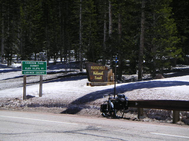 Cameron Pass
 Cache la Poudre River
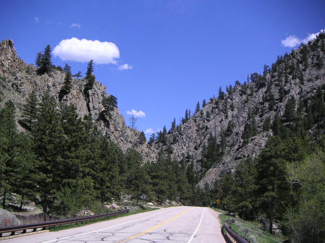 Descent through Cache la Poudre Canyon
21 May - Saturday -101.8 miles/1406 total
Fort Collins to Sterling
The direct route
eastward to Nebraska continues along Colorado 14, the road I’d been on
since Rabbit Ears Pass, so I headed out along that empty stretch of
road very early in the morning, as I had another century to do.
There was a
strong north wind, which was sometimes a little westerly (good), and
sometimes a little easterly (bad). And from time to time the road
direction would shift a little, into or out of the wind. Altogether,
though, I had a bad wind day.
Ault, at 14
miles, was the last town I was confident I could buy food in, so a got
a sandwich there for lunch later. Farther on, I stopped briefly for
something to drink in Briggsdale, slightly off the main road, a town
with two tiny stores and no paved streets except for the bordering
county roads.
At a little more
than halfway, the road construction began. First there was two miles of
dirt, where the asphalt was removed completely. But after that two
miles, the road surface was merely half-stripped, and grooved. The
grooves made it difficult to keep my balance and make holding the
handlebars almost painful. When I got to New Raymer and stopped for a
Gatorade, the woman in the store promised another eight miles of
construction. Eventually, though, I figured out that only my side of
the road was grooved; I could ride on the
shoulder of the other side in reasonable comfort. So I did that until
the end of the construction.
A bit before
Sterling the terrain started rolling a little. That, combined with the
heat - it was in the upper eighties, unseasonably - and the
construction I’d just ridden through put me a fairly bad temper as I
rolled into Sterling. But I found a motel, again near the freeway, and
had dinner, once again at the motel next door.
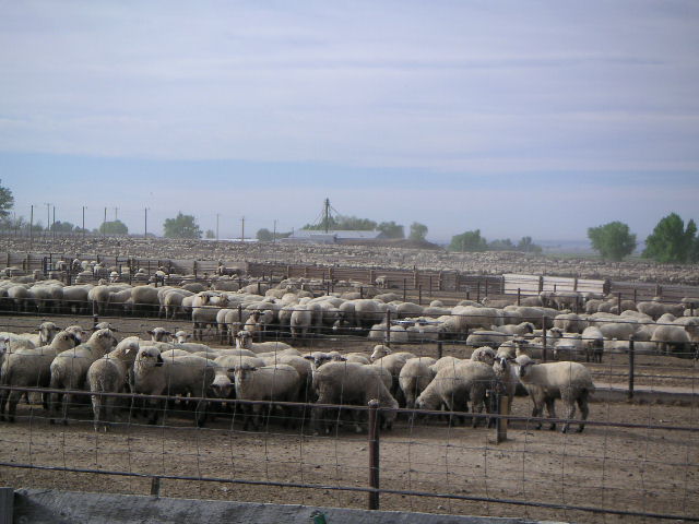 Feed lot lamb chops, with maybe some mutton among them. East of Ft. Collins
22 May - Sunday - 85.5 miles/1491 total
Sterling CO to Imperial NE
Colorado 14 ends
in Sterling, so I’ll be continuing on US 6, which goes in the same
direction and is a little better populated. Leaving Sterling means
climbing out of the valley of the South Platte, which looks like it
shouldn’t be a big deal, but there were some rollers. I think I gained
a few hundred feet between Sterling and Fleming.
At this point,
the towns were getting to be close enough so that I could see the next
one’s grain elevator from the previous one. The headwind continued,
slowing me considerably.
I stopped for
lunch in Holyoke, a very pleasant town of about 1000 with a lot of
trees. The Nebraska border was now only twelve miles away, and when I’d
got halfway there, I met a road cyclist from Holyoke going the other
way, just finishing up an 80 mile training ride. He was getting ready
for the annual ride across Nebraska, and had done the same distance the
day before. We commiserated a while about the wind, and talked about
touring - he said he was eventually planning to do a tour from Colorado
to Idaho - probably when he retired. So far he’s the second cyclist
I’ve met on this trip who was waiting until retirement to tour.
My goal for the
day had been a state park campground about 34 miles into Nebraska, but
as I entered Imperial, 24 miles in, I saw a sign for a B&B, and
decided this would be a good place to stop. After all it was Sunday,
and I wasn’t sure how easy it would be to get food before the
campground. And I felt like some comfort. So I stopped at the Balcony
B&B, an old, big, airy clapboard house that had been the original
town school, then a tourist camp in the twenties. It was owned by a
couple in their forties, with a couple of kids. A nice place. But it
was Sunday night, and the only place open to eat in town was a
sub-standard Pizza Hut, so I contented myself with sub-standard pizza
for dinner.
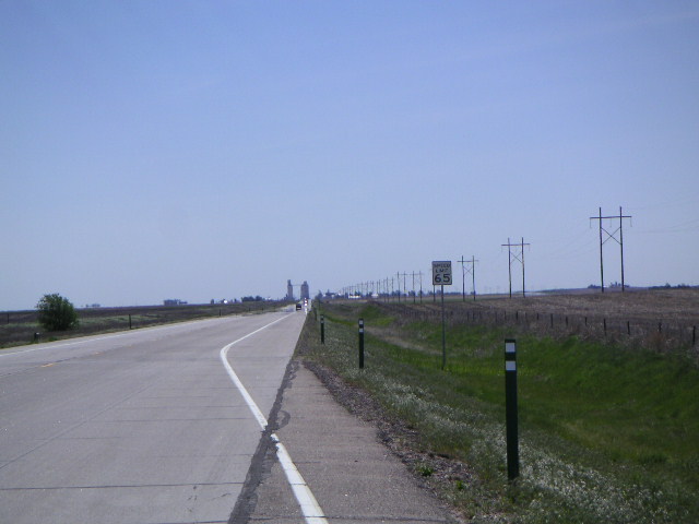 Paoli, CO in the distance
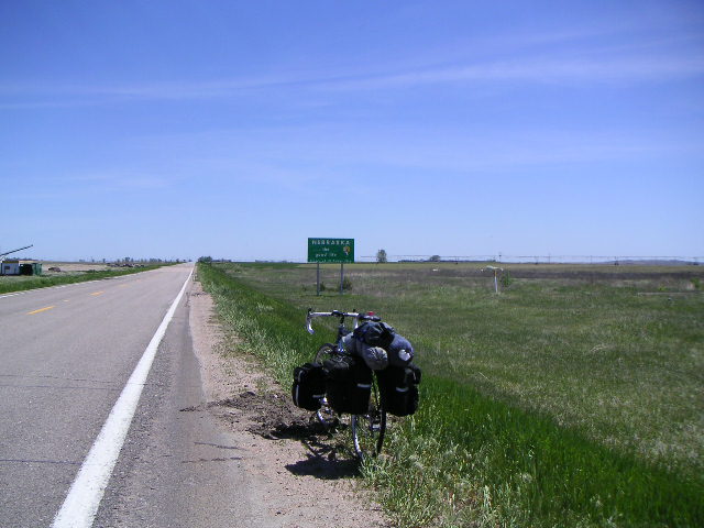 Nebraska